
Topoplan
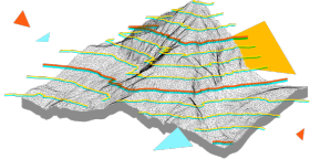
nanoCAD’s Topoplan module extends the nanoCAD platform with tools for digital terrain modeling and documentation. It is designed to make the work of surveyors more efficient.
nanoCAD platform provides you with a full set of basic and advanced design tools for creating and editing 2D/3D objects. It offers multiple drawing and editing methods for most geometric elements. nanoCAD platform is the base on which you build a more powerful CAD system to your specifications.
nanoCAD's Topoplan module extends the nanoCAD platform with tools for digital terrain modeling and documentation. It is designed to make the work of surveyors more efficient.
New in Topoplan
Main features
Surface Difference
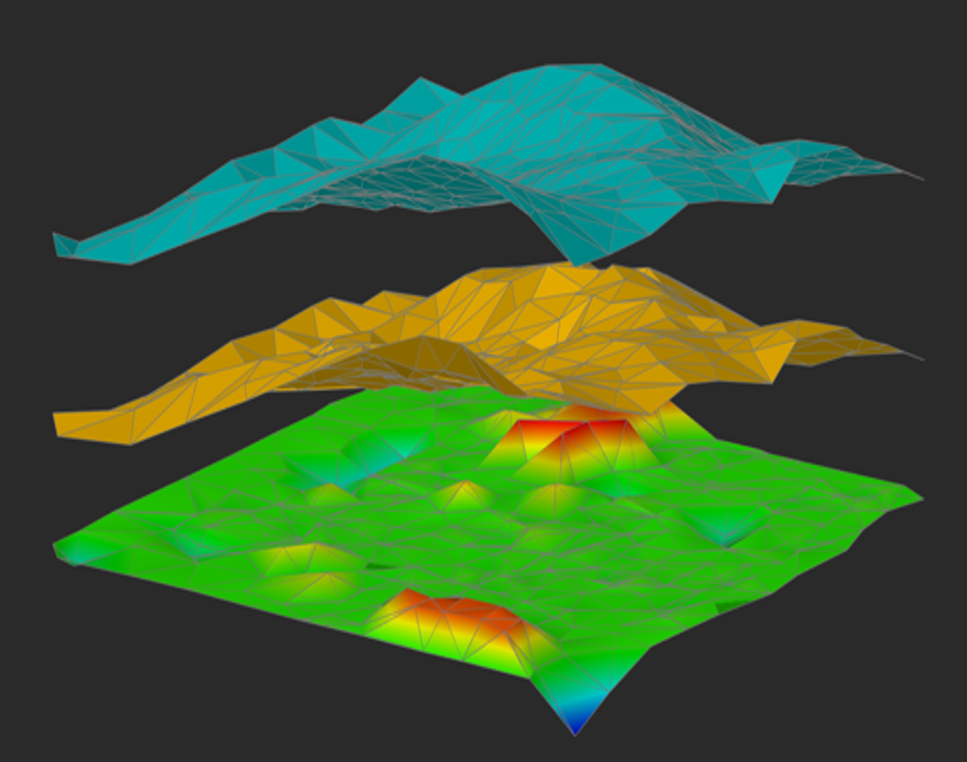
The Height Difference (NG_HEIGHT_DIFFERENCE) command creates a new surface as a result of subtracting one surface from another.
Topographic Hatches
Filling the contour with conventional signs. You can set the type of filling, step, angle of rotation, a combination of several symbols.

Coloring Elevation Legend
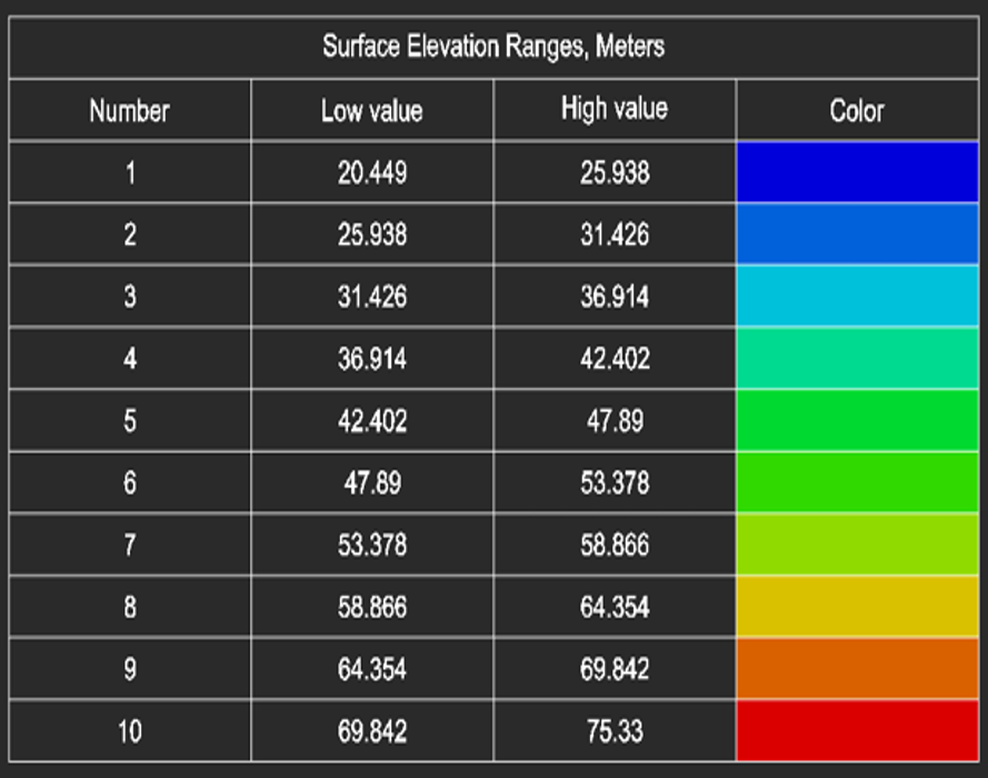
Generation of elevation legend for a height-colored surface.
Export Geopoints
TThe Export geopoints (NG_EXPORT_POINTS) command allows you to: export such objects as geopoints, blocks, simple points to txt, csv, sdr format, with the possibility to create labels in the drawing; save the label’s rotation value or other user attributes when exporting to an external file; select encoding.

User-Defined Properties of Geopoints
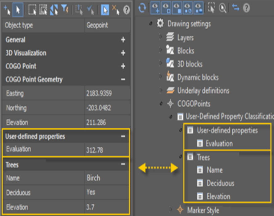
You can set user-defined properties for geopoints. If you have additional data that cannot be distributed over existing standard geopoint properties, you can define your own user-defined properties.
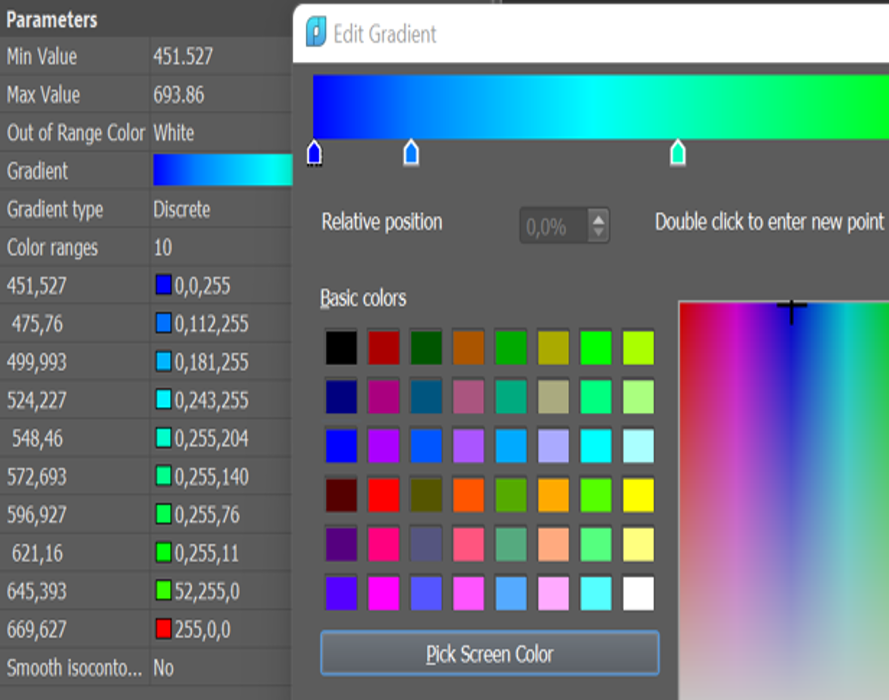
Painting Mesh by Elevation
Expanded options for coloring the surface by blevation. Now it is possible to customize, save and load the gradient from a file.
Import of KML/KMZ files
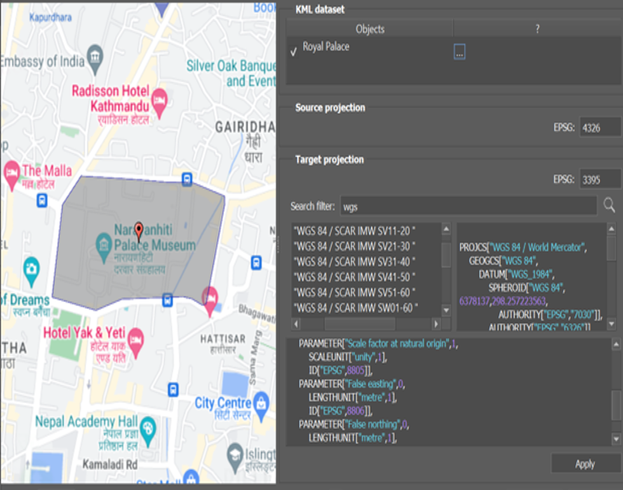
A preview window has been added to the import of KML/KMZ files. Now it is possible to search coordinate systems to transform.